


Voting District 0200032, Suffolk County, New York
About
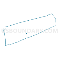
Outline

Summary
| Unique Area Identifier | 637495 |
| Name | Voting District 0200032 |
| County | Suffolk County |
| State | New York |
| Area (square miles) | 1.60 |
| Land Area (square miles) | 1.53 |
| Water Area (square miles) | 0.07 |
| % of Land Area | 95.86 |
| % of Water Area | 4.14 |
| Latitude of the Internal Point | 40.82786700 |
| Longtitude of the Internal Point | -72.73586840 |
Maps


Graphs
Select a template below for downloading or customizing gragh for Voting District 0200032, Suffolk County, New York


Neighbors
Neighoring Voting District (by Name) Neighboring Voting District on the Map
- Voting District 0200151, Suffolk County, NY
- Voting District 0200265, Suffolk County, NY
- Voting District 0200272, Suffolk County, NY
- Voting District 0200279, Suffolk County, NY
- Voting District 0900011, Suffolk County, NY
- Voting District 0900019 0900041, Suffolk County, NY
Top 10 Neighboring County Subdivision (by Population) Neighboring County Subdivision on the Map
Top 10 Neighboring Place (by Population) Neighboring Place on the Map
- Manorville CDP, NY (14,314)
- East Moriches CDP, NY (5,249)
- Eastport CDP, NY (1,831)
- Northampton CDP, NY (570)
Top 10 Neighboring Elementary School District (by Population) Neighboring Elementary School District on the Map
Top 10 Neighboring Unified School District (by Population) Neighboring Unified School District on the Map
- Eastport-South Manor Central School District, NY (18,927)
- East Moriches Union Free School District, NY (5,755)
Top 10 Neighboring State Legislative District Lower Chamber (by Population) Neighboring State Legislative District Lower Chamber on the Map
Top 10 Neighboring State Legislative District Upper Chamber (by Population) Neighboring State Legislative District Upper Chamber on the Map
Top 10 Neighboring 111th Congressional District (by Population) Neighboring 111th Congressional District on the Map
Top 10 Neighboring Census Tract (by Population) Neighboring Census Tract on the Map
- Census Tract 1904.01, Suffolk County, NY (7,953)
- Census Tract 1594.10, Suffolk County, NY (7,819)
- Census Tract 1594.06, Suffolk County, NY (4,279)
- Census Tract 1596.02, Suffolk County, NY (4,249)
- Census Tract 1905.03, Suffolk County, NY (3,368)
- Census Tract 1904.02, Suffolk County, NY (2,752)
Top 10 Neighboring 5-Digit ZIP Code Tabulation Area (by Population) Neighboring 5-Digit ZIP Code Tabulation Area on the Map
- 11901, NY (27,172)
- 11949, NY (14,573)
- 11933, NY (6,844)
- 11940, NY (5,210)
- 11941, NY (1,986)
- 11972, NY (1,321)